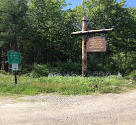
Horse Hill Nature Preserve
Downloads:
Insects of Horse Hill Nature Preserve Brochure
Orienteering Map / Instructions
*Note: The trail map is designed to be a tri- fold. This means you should try to print the map double sided and then fold it so that the map is in the middle and each side is folded in over the map. Follow the link to see what a tri-fold looks like.
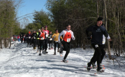
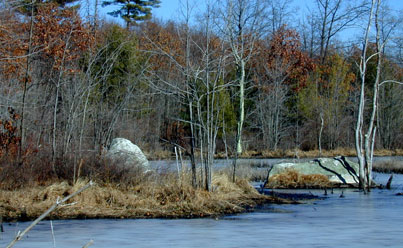
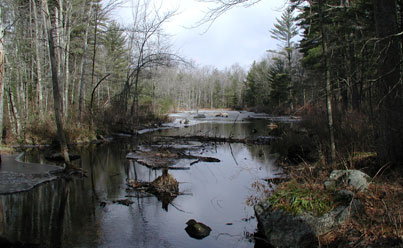
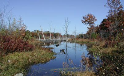
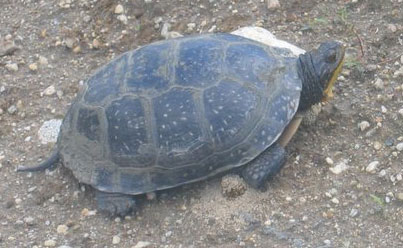
Click to see more photos of Horse Hill Nature Preserve.
Property Description:
In April of 2002, the Town of Merrimack voted to purchase the property now known as the Horse Hill Nature Preserve. Due to its size, quantity of wetlands, and impact on wildlife and water resources, this property was listed as the top priority for conservation in the 2002 Town of Merrimack Master Plan.
The 563± acre property consists of gently rolling to fairly steep terrain and two hills approximately 400' elevation. The land was cleared for pasture many years ago, it has been logged several times, and now consists primarily of mixed hardwood forest with trees between 20 and 60 years of age. The property includes a series of streams, ponds, swamps, and numerous wetlands totaling approximately 60 acres. The varied terrain, habitat, and large areas of undisturbed open space have encouraged a wide variety of wildlife to thrive on the property.
A power line easement traverses the property, creating a shrubland undergrowth area. A small sandpit was created by previous owners, but sand has not been removed for several years.
Old logging roads form the basis of what is today a trail network used by hikers, bikers, hunters, snowmobilers, horse back riders, etc. This trail network covers the majority of the property, however, there are still large areas without defined access.
Horse Hill is the largest preserved open space property in the Town of Merrimack and wide range of opportunities for both passive and active recreation as well as diverse habitats for plants and wildlife.
Unique/Historic Features:
The Preserve takes its name from Horse Hill, one of two 400' hills located within the Preserve. Blodgett Hill, the highest point within the Preserve, is named for the Blodgett family who were early settlers of this part of Merrimack. The Spalding family were also early settlers, and the foundation of the house of a Captain Spalding is located in the Preserve. Numerous stone walls still mark the one time farming activities of these two families. Two hand dug, stone lined, wells are located on the property. One of these wells is still in use today. A well preserved portion of Old Kings Highway, a Colonial road which once ran from Keene to Portsmouth, crosses the southeast corner of the Preserve.
Helpful Info
Address:
Horse Hill Nature Preserve
184 Amherst Rd. Merrimack, NH 03054
GPS:
42° 50'44.02" -71° 32'51.44"
Permitted Activities:
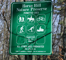
Hiking, biking, cross country skiing, snowshoeing, hunting, snowmobiling and horseback riding, Class 1 E-Bikes.
Prohibited Activities:
Camping, fires, operation of motor vehicles, operation of off highway recreational vehicles. Class 2 and 3 E-Bikes, discharge of air-powered or spring-powered guns, any type of bow, or any firearm for the purpose of target shooting.
Hours of Use:
There are no hours restrictions on this property.